Excessive Heat & Storms for Weekend Ahead
Excessive Heat and Thunderstorms on tap for the weekend
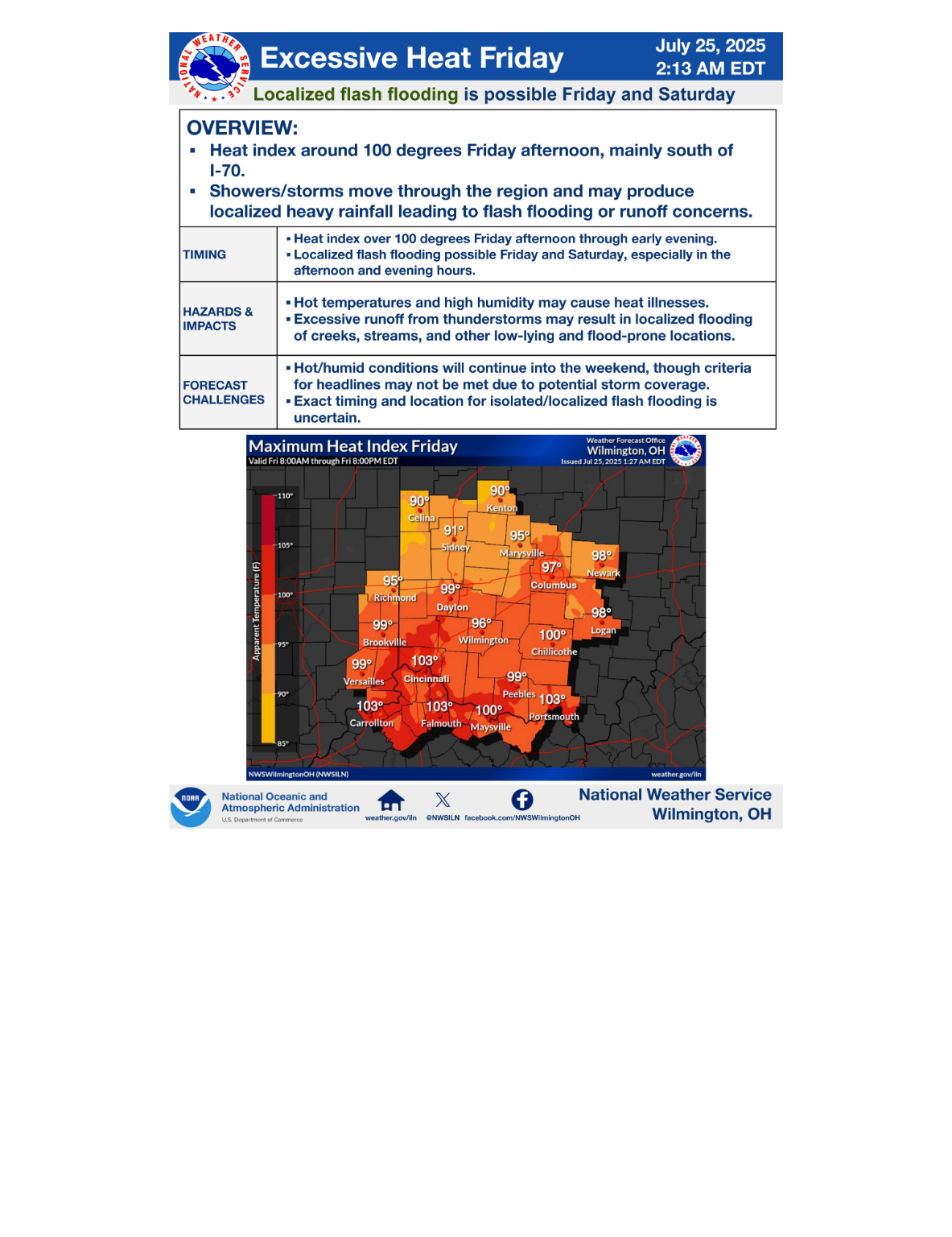
▪ Heat index around 100 degrees Friday afternoon, mainly south of I-70.
▪ Showers/storms move through the region and may produce localized flash flooding. Stronger storms may produce damaging winds.
TIMING
▪ Heat index over 100 degrees Friday afternoon through early evening.
▪ Localized flash flooding and damaging winds possible Friday, particularly during the afternoon and early evening hours.
HAZARDS & IMPACTS
▪ Hot temperatures and high humidity may cause heat illnesses.
▪ Excessive runoff from thunderstorms may result in localized flooding of creeks, streams, and other low-lying and flood-prone locations.
▪ Damaging winds may result in downed trees or power lines.
FORECAST CHALLENGES
▪ Hot/humid conditions will continue into the weekend, though criteria for headlines may not be met due to potential storm coverage.
▪ Afternoon storms will be scattered in nature, so timing/location of flooding and wind concerns is hard to pinpoint.